Case 1: Native Americans and Colonial Origins
Interpretive Text:
On the northwest corner of the Louisiana State University campus stand two ancient mounds. The mounds, created by Native Americans, functioned as ceremonial centers, base camps for hunting and gathering, and symbols of group identity. Radiocarbon dating shows that mound builders came to the "red stick" area about 5,000 years ago to live on the bounty provided by the Mississippi River.
In 1699 French visitors called the spot "red stick" baton rouge because of a boundary marker pole, stained with animal blood, standing on the river bluff. Members of the Houma tribe lived to the north of the red stick and Bayogoulas to the south. In 1706 the Terrebonne and Lafourche Parishes. The Tunica-Biloxi Indian Tribe of Louisiana is centered in Marksville, LA.
No French settlement existed until 1718, when records show that two whites and 25 blacks resided on land granted to Bernard Diron Dartaguette, 95 leagues from the mouth of the Mississippi. By 1727 they were gone. Historian Mark T. Carleton explains that "'French' Baton Rouge...is of little historical importance. The origins of Baton Rouge as a continuously settled ... community do not, in fact, date from the French period at all, but rather from the establishment there in 1763 of a British military outpost."
After the French and Indian War of 1756-1763, France ceded western Louisiana and New Orleans to Spain and lost Canada and eastern Louisiana to the British. Thus Baton Rouge became the strategically important southwestern corner of British North America. On the site of the earlier French settlement, the English established Fort New Richmond and named naval Captain George Johnstone the first governor of the "West Florida" colony. Many present-day Baton Rouge citizens can trace their ancestry back to those who received land grants from Johnstone.
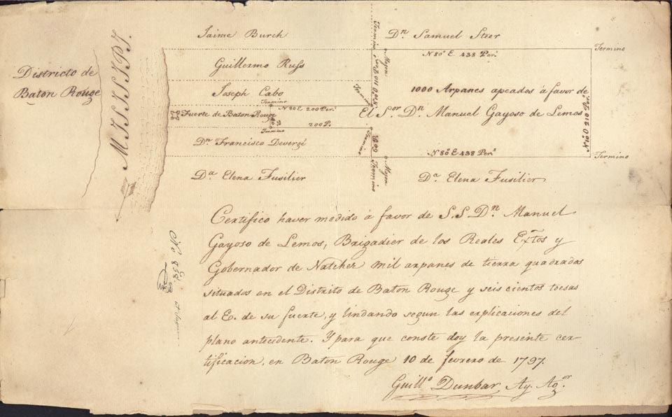
Although Spanish explorers passed the Baton Rouge area on the Mississippi River in 1542, Spanish influence is not evident until 1779, when Spain captured Fort New Richmond and renamed it Fort San Carlos. With the removal of British restrictions on settlement, the Mississippi Valley fell open to invasion by thousands of pioneers from the new United States. Louisiana governor Manuel Gayoso de Lemos received one of the two largest land grants in the Baton Rouge District during this period. The other went to Elias Beauregard.
In September 1810 Americans residents of Fort San Carlos, with the backing of the United States, rose against Spanish rule, took over the fort, and raised the flag of the "West Florida Republic." In October 1810 President Madison authorized William C. C. Claiborne, governor of the neighboring Territory of Orleans, to take over the West Florida Republic. Citizens changed the settlement's name back to Baton Rouge.
Items Displayed:
Items listed below were part of the exhibition but some are not pictured on this page.
LSU Museum of Natural Science. The LSU Campus Mounds: A National Treasure. Baton Rouge: The Museum, 1998. Courtesy of the Museum.
B. F. French, Historical Collections of Louisiana.... New York: Lamport, Blakeman & law, 1853. LLMVC Rare F366 F87, v. 5, c 4.

